Website

Lorem ipsum dolor sit amet, consectetur adipisicing elit. A ullam sequi nobis. Adipisci, earum accusantium perspiciatis placeat reiciendis.

Link

In This Issue

Hello again! Thank you for taking the time to look through our latest quarterly newsletter, focused on what's new with Trimble's Civil Engineering and Construction software. Read on!


We Want to Hear From YOU!

How have Trimble's software solutions helped you solve an unusual or difficult issue?

Tell us about it below
We might want to use your story in an upcoming newsletter, please include your name and email address so we can contact you!

Product Info | TILOS Version 10 Release

Smarter. Easier. Accurate. Optimized.

Creating linear project plans using traditional Gantt software can be cumbersome and inaccurate. Trimble® TILOS transforms the way linear project plans are created by integrating a scaled diagram of your project with a comprehensive project management system tailored for Railway, Road, Pipeline, Tunnel and Transmission line projects.

TILOS combines time and location to give you a smarter, easier way to create accurate, optimized plans, and to quickly update these plans as schedule changes occur.

Version 10, the latest version of TILOS, includes many new features:
  • Mass haulage features and enhancements
  • Usability improvements to project setup and printing
  • Gantt chart improvements for scheduling
  • Time distance chart optimizations
  • Progress management improvements
  • And more! 

New to Trimble TILOS software?

Find a range of training videos on the TILOS website or contact your local SITECH dealer with any questions today.

Product Info | What's New With Business Center - HCE


Business Center - HCE – Version 4.0 is here!

Business Center - HCE from Trimble facilitates the management of data for multiple field crews operating on a job site. You can import, review, and analyze digital designs, and then assign, manage, and track that information through the lifecycle of a construction project. Powerful tools help you create accurate, integrated 3D models for sites, highways and marine applications quickly and easily. Make better decisions, decrease costly mistakes, and increase efficiency in the office and on the job site.

Business Center - HCE version 4.0 has a range of new features, including:
  • Insert DigitalGlobe Imagery Background Maps
    • Using the Toggle Background Map command, you can now insert geo-referenced background maps supplied by DigitalGlobe Imagery, a provider of global high-resolution satellite imagery based on a 16-year time-lapse image library (a free Trimble Connect login is required)
  • Rock Face Modeling
    • The Create Tunnel Surface has been enhanced so it can be used to better model near-vertical rock faces (including overhangs)
  • Better Mass Haul Viewing and Plotting
    • All mass haul ordinate objects (including borrow pits, waste sites and barriers) are now placed on appropriate mass haul layers; control what is visible and prepare for plotting
  • Create Points Using Single Proportioning
    • The Single Proportioning command provides a powerful tool for locating or re-establishing missing survey markers by reconciling recorded and measured distances
    • Create one or more proportioned points between two measured points or along measured segment lengths using either planar (grid) or geodetic (global) calculations
    • Utilize fixed-length record distances (for a right-of-way, for example) and relative record distances when computing the proportioned point(s)
  • Import CAD Data from PDF to Plan Set Sheets 
    • Import CAD data from a PDF file directly onto sheets in a plan set
    • If you import additional PDFs with this option enabled, each creates a separate plan set
Also, did you know, Business Center - HCE extracts and imports all files automatically from a zip file when you drag and drop it in? Awesome!
Click here to download version 4.0, or contact your local SITECH dealer today.


Business Center - HCE Data Sheets
5 new packs, organized to improve YOUR workflow 

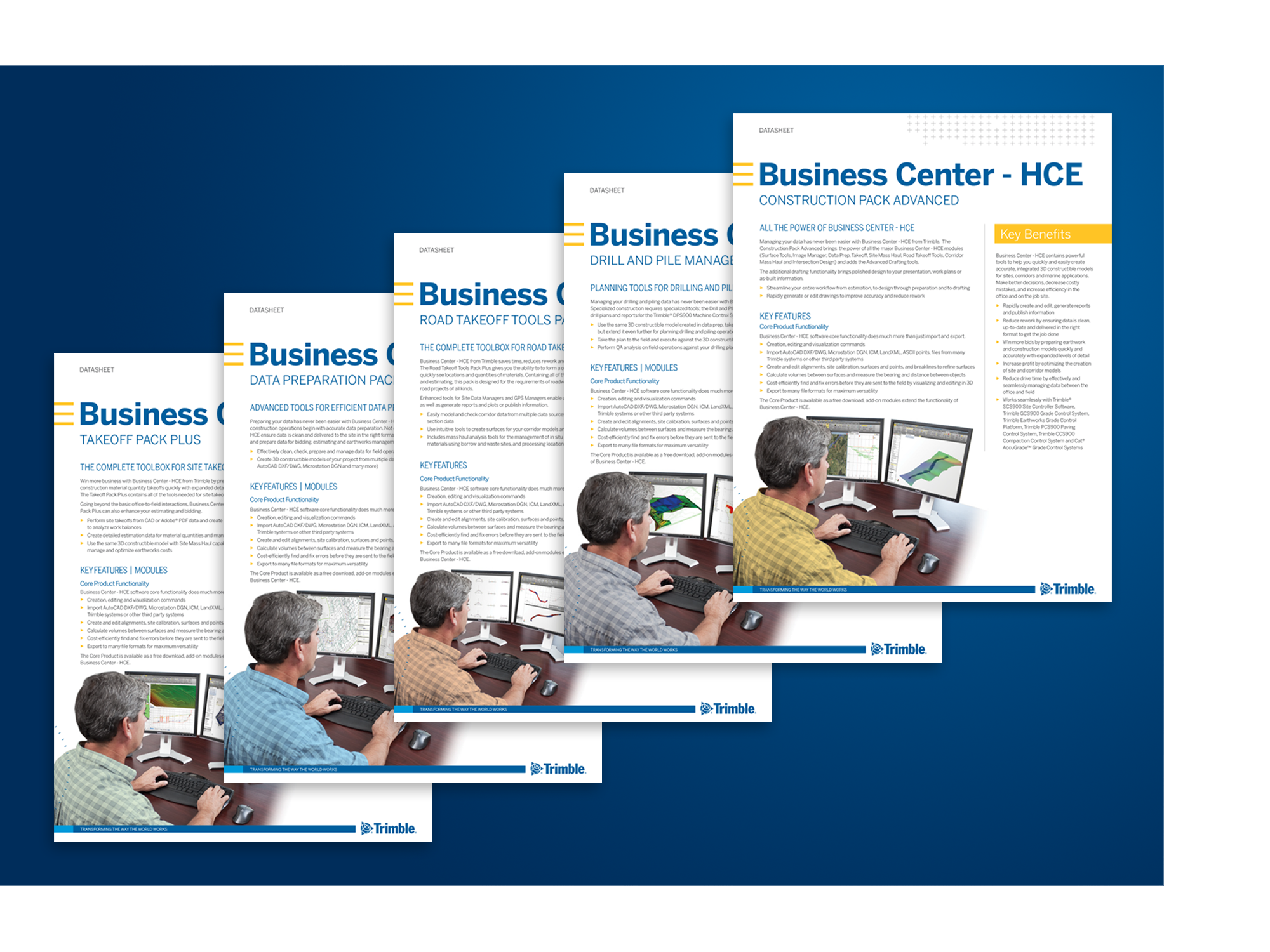
In addition to the core product functionality, Business Center - HCE modules are available to tailor the software to your specific needs. A new set of data sheets explains the different packs, which modules they include and how they can transform the way you work. Click on the links below to download the PDFs:

Drill and Pile Manager Pack

Construction Pack Advanced

Road Takeoff Tools Pack

Takeoff Pack Plus 

Data Prep Pack


Poll question: Which of Business Center - HCE's new/improved feature(s) are you most interested in? 

  • Insert DigitalGlobe Imagery Background Maps
  • Rock Face Modeling
  • Better Mass Haul Viewing and Plotting
  • Create Points Using Single Proportioning
  • Import CAD Data from PDF to Plan Set Sheets 


NEW | Trimble Stratus

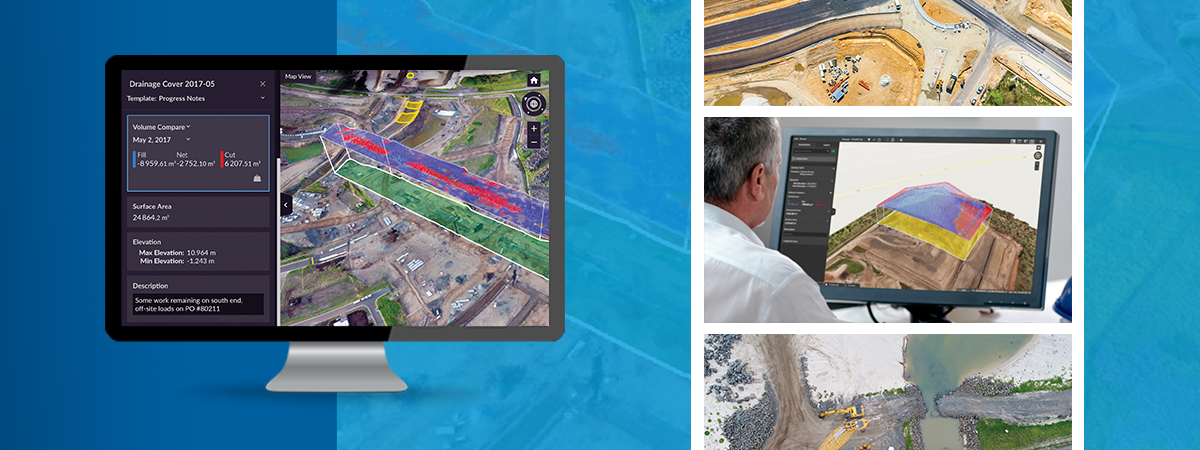
Trimble Stratus | Drone Data Platform for Construction

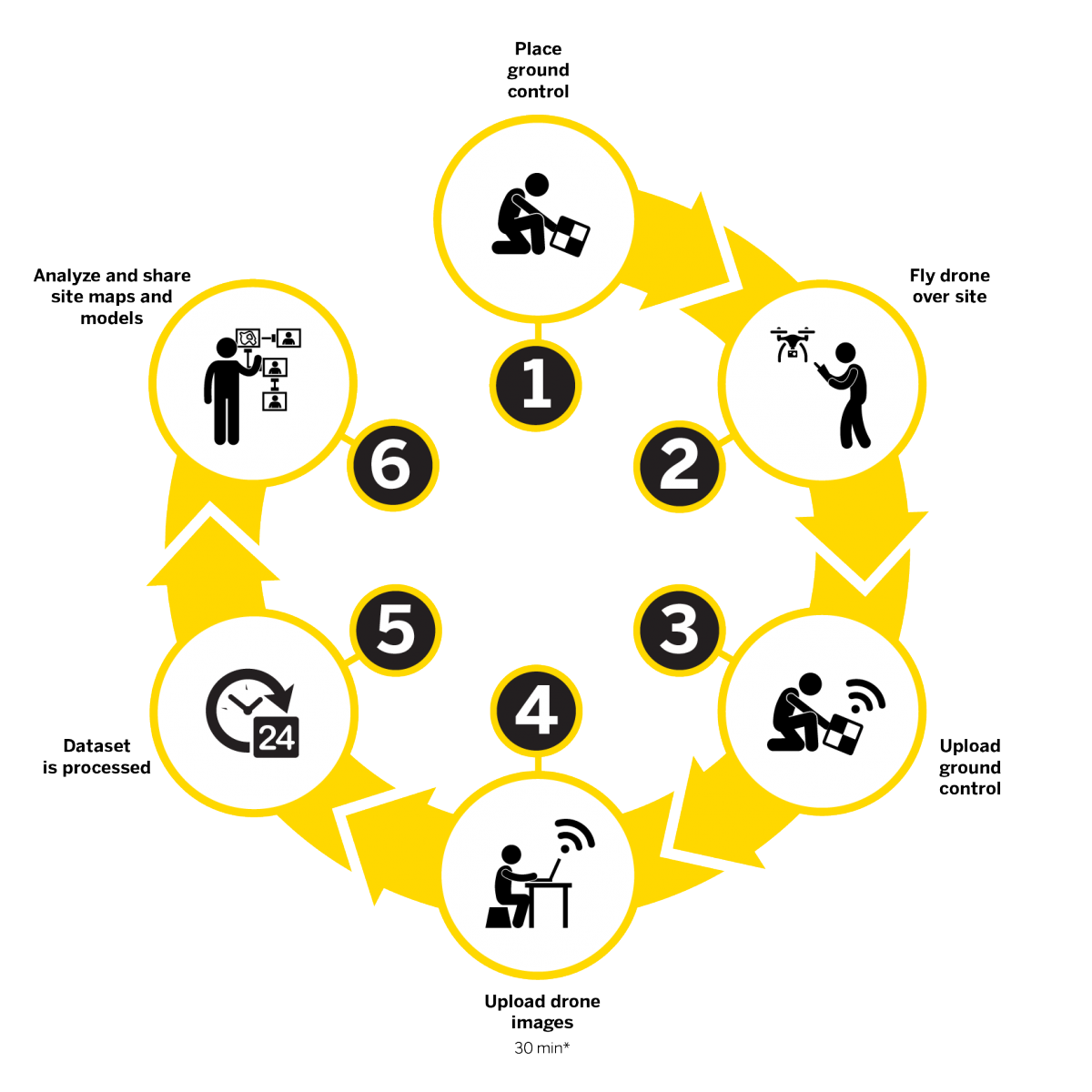
Trimble Stratus software helps civil contractors use drones to map, measure and share accurate information about their worksites and assets. With Stratus, you can make quicker decisions, avoid mistakes, and grow profits by always having the right information on hand.

So, how does it work?


How can Trimble Stratus improve my workflow?

  • Plan and estimate with more confidence
  • Conduct your own site surveys frequently and faster
  • Communicate effectively, a visual timeline keeps everyone on the same page
  • Save on consultants and avoid information bottlenecks


Already using Trimble Stratus?

Keep your construction site closer to the design with the volume compare and cross section tools
Anyone who works in heavy construction knows that matching the design file as closely as possible is the name of the game. Contractors who succeed in this will save themselves both time and money, and protect their reputation in the sector as a company that gets the job done right the first time.

The more frequently the design can be referred to, the easier it is to manage design conformance – and the happier your clients will be in the end.

Comparing Volume

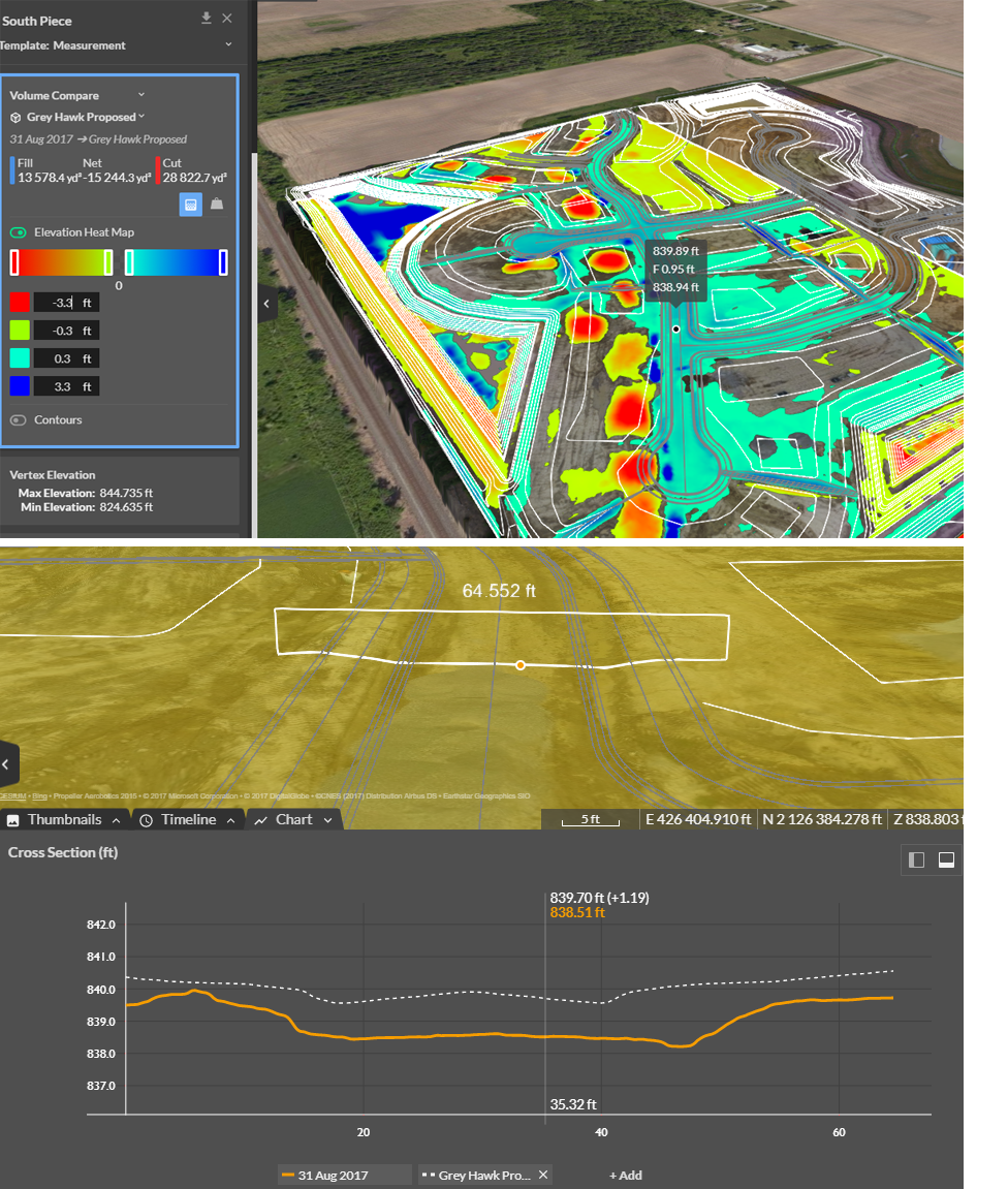
Understanding the cut and fill measurements for a certain area of terrain can be incredibly helpful when grading a section of your site. The volume compare tool provides both of these measurements as compared to the design file, alongside a visual heatmap showing exactly where to cut and fill the area with a “live” cut/fill values whenever you hover your mouse over the surface.

Comparing Cross-Section Heights

The height difference between the design file and the actual surface can also be a crucial measurement to understand. The cross section tool is the best resource for this, offering a clear, visual display of the height measurements of the current site compared to the design file.

This is a quick and convenient way to measure your progress, especially if you’re working in road construction.

View the original blog post here.

To find out more about Trimble Stratus, click here to visit the website, or contact your local SITECH dealer today.


Events | Trimble Dimensions


SAVE THE DATE | November 5-7, 2018 in Las Vegas, Nevada

Experience an unparalleled combination of technology, networking and education
at Trimble Dimensions International User Conference

The power of technology is transforming the way you work. Join us at Dimensions 2018 to see how our hardware, software and service solutions maximize productivity and boost profitability across agriculture, construction, geospatial, transportation and logistics and other emerging industries. Click here to find out more, or click the button below to be alerted when registration opens:


facebook twitter YouTube LinkedIn Instagram